
![Wing Earth - Large-scale Point Cloud Processor [i-Construction compliant]](images/top_main_img.png)
What is WingEarth?
WingEarth is a three-dimensional point cloud processor that makes use of the expertise of the high-accuracy positioning technology that AISAN TECHNOLOGY has accumulated over the years.
WingEarth is a user friendly processor based on a newly developed point cloud processing engine, and can process point cloud data obtained from UAV (Unmanned Aerial Vehicle), TLS (Terrestrial Laser Scanner), or MMS (Mobile Mapping System) at high speed.
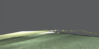
High-speed display of massive point clouds
that exceed 10 billion point
WingEarth can display data sets exceeding 10 billion point at high speed. When mapping, displaying only the point clouds necessary for operation enables data processing without being influenced by unnecessary point clouds.

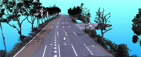
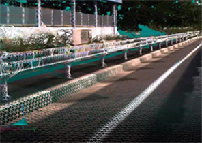
Large point of load
Edge display
A variety of functions,
including automatic object recognition and point cloud editing
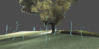
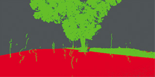
Object recognition, the most labor-intensive part of point cloud processing, is now possible with one click.
Extract, delete, undo, and group operations can be performed easily, enabling smooth editing.
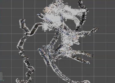
Object recognition_part1
Object recognition_part2
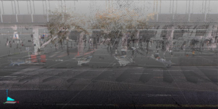
Enhanced point cloud noise removal function,
such as ground filtering
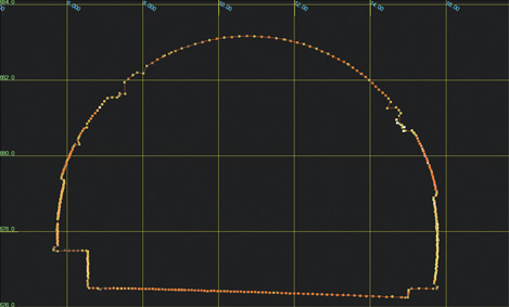
This function estimates the ground based on the point cloud for each specified range, and removes distant point clouds that have a thickness of more than the estimated value from the ground.
A variety of filtering functions are available in response to customers' requirements.
ground filtering
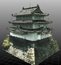
High-definition mesh creation
[3D mesh]
A realistic configuration of the topography can be created as a mesh image.
Creation of a 3D mesh image allows you to understand the three-dimensional shapes of the surface layers of point clouds.
-
3D mesh image of wheel guard -
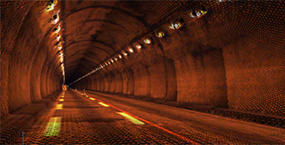
3D mesh image of tunnel wall
3D mesh
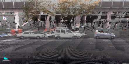
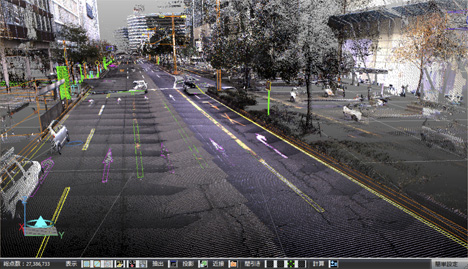
Enhanced mapping support functions
You can perform three-dimensional tracing using a function that highlights the edges of point cloud object shapes or reflected intensity of scanned data (patent pending), as if you are performing two-dimensional graphical editing.
These functions include some CAD functions that draw connections by projecting 3D data onto a plane and perform mapping while estimating three-dimensional shapes based on point clouds around power poles and an Oltho image creation function.
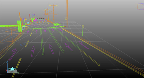
Create a shape
Cross-section creation/editing function
Cross-sectional images can be created and edited.
Even when point clouds exist at the upper and lower sections of a space like a tunnel, the outline can be easily created.
Supporting earthwork value calculations
Cutting and filling quantity required for construction works can be calculated, and a visualized heat map can be displayed.
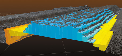
Earthwork volume calculation
Operating environments
| Horizontal Scrolling→ | No. of points to be read | |||
|---|---|---|---|---|
| Approx. 10 billion | Approx. 6 billion | Approx. 2 billion | Approx. tens of millions to 100 million |
|
| Applicable OS (as of March 2017) |
Windows® Professional 64 bit Windows® 8.1 Pro 64 bit Windows® 10 Pro 64 bit * 64-bit operating system only. Not supported on 32-bit operating system. |
|||
| CPU | Intel® Xeon® 3.0GHz or more 8 cores or more Third level cache of 20 MB or more |
Intel® Core™ i7 3.0GHz or more 6 cores or more Third level cache of 15 MB or more |
Intel® Core™ i7 3.0GHz or more 4 cores or more Third level cache of 8 MB or more |
|
| RAM | 64 GB or more | 32 GB or more | 24 GB or more | 16 GB or more |
| Graphics | 4 GB or more | 2 GB or more | ||
| HDD | Free space of 1 TB or more | Free space of 250 GB or more |
Free space of 50 GB or more |
|
| Display | Resolution of 1920 x 1080 pixels or higher (High Color 32 bit or higher) * Wide type recommended |
|||
| Others | USB 3.0 port Internet connection required |
|||